Missouri River Border Water Boat Ramps
Trying to figure out where to launch your boat on the sprawling Missouri River, especially along those border stretches where regulations can get murky, can feel like you need a legal degree and a seasoned river guide all in one. It’s tough enough knowing the best spots to fish, let alone ensuring you’re launching legally and safely while dealing with ever-changing river conditions. This guide is here to untangle all that confusion, giving you the lowdown on the prime boat ramps on Nebraska's Missouri River border waters and everything you need to know for a smooth, stress-free outing.
Getting Started: Essential Knowledge for Missouri River Border Waters
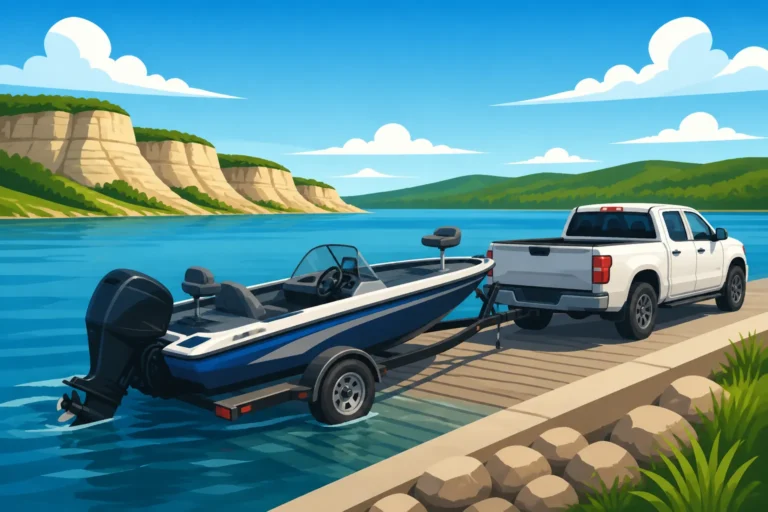
Launching your boat on the Missouri River isn't quite the same as dropping it into a placid lake. There are unique considerations, especially when you're dealing with border waters. These areas often mean navigating regulations that might overlap or differ slightly between Nebraska and its neighboring states like Iowa, Missouri, or South Dakota. It's not just about finding a ramp; it's about being prepared and compliant.
Navigating Fishing License Reciprocity and Rules
One of the biggest headaches for anglers on the Missouri River is understanding where your fishing license is valid. Thankfully, Nebraska often has reciprocity agreements with adjacent states for waters that form a common boundary. This means if you have a valid Nebraska fishing license, you can generally fish the main stem of the Missouri River along the Nebraska-Iowa or Nebraska-South Dakota borders without needing a separate license from the other state. However, it's crucial to remember that these agreements usually only apply to the main channel and associated backwaters that are directly accessible from the main channel. Tributaries, oxbows, or specific embayments entirely within one state's boundary typically require that state's license.
For instance, if you're launching on the Nebraska side of Lewis and Clark Lake and plan to fish the entire lake, your Nebraska license is usually sufficient. But if you decide to venture up a creek that flows into the Missouri River, and that creek is entirely within Iowa, you might need an Iowa license. The details can be intricate, so always double-check the latest rules from both Nebraska Game and Parks Commission and the relevant state's wildlife agency before you head out. Understanding the specifics of Missouri River Border Water Fishing License Rules is absolutely paramount to avoid any unexpected fines or complications.
Understanding Boat Registration and Aquatic Invasive Species Stamps
Beyond fishing licenses, your boat itself has rules to follow. If your boat is primarily used and registered in Nebraska, you're usually good to go on the border waters. However, you must ensure your Nebraska Boat Registration and Fishing Rules are up-to-date. This includes displaying your registration numbers correctly and carrying your registration certificate onboard.
A critical, often overlooked requirement is the Aquatic Invasive Species (AIS) stamp. Nebraska, like many states, requires this stamp for most motorized boats and some non-motorized vessels to fund efforts against invasive species like zebra mussels. If you're coming from out-of-state, your boat might need an inspection, and you'll definitely need to follow the "Clean, Drain, Dry" protocol every time you pull your boat out of the water. Learning How to Clean a Boat to Prevent Zebra Mussels in Nebraska is not just a recommendation; it's a legal and ethical responsibility to protect our precious waterways.
Safety and Navigation on the Dynamic Missouri River
The "Big Muddy" is a powerful, constantly changing river. Its currents can be strong, especially after heavy rains or during periods of high water release from upstream dams. Debris like logs and snags are common, posing significant hazards to navigation. Commercial barge traffic also uses the river, and these massive vessels create enormous wakes and require a wide berth.
When planning your trip, always check river levels and flow rates. The U.S. Army Corps of Engineers websites often provide real-time data for various points along the river. Be sure your boat is equipped with all the Required Safety Equipment on a Nebraska Boat, including life jackets for everyone on board, a fire extinguisher, signaling devices, and navigation lights. Always let someone know your float plan, including where you're launching, where you intend to go, and when you expect to return. The Missouri River demands respect, and being prepared is your best defense against its unpredictable nature.
Navigating Northern & Central Nebraska's Missouri River Boat Ramps
The Missouri River flows along hundreds of miles of Nebraska's eastern border, offering diverse angling opportunities. From the vast, open waters of Lewis and Clark Lake in the north to the more channeled sections near Omaha, each stretch presents its own unique set of boat ramps and challenges. Knowing these access points is key to a successful outing.
Northern Border Ramps: Lewis and Clark Lake and Upstream
Up in the northeastern corner of Nebraska, where the Missouri River forms the border with South Dakota, you'll find the expansive Lewis and Clark Lake. This reservoir, created by Gavins Point Dam, is a popular destination for all kinds of boating and fishing, especially known for its walleye. The boat ramps here are generally well-maintained and designed to handle significant traffic, but understanding their specific features is important.
- Weigand Marina State Recreation Area (SRA) (Crofton, NE): This is one of the most popular and comprehensive access points on the Nebraska side of Lewis and Clark Lake. It boasts multiple concrete ramps, ample parking, and full-service marina facilities, including fuel, a bait shop, and camping. It’s an ideal launch for larger boats targeting walleye, crappie, and catfish in the main lake. The convenience here is hard to beat, making it a favorite for many anglers.
- Miller Creek Recreation Area (Crofton, NE): Just a bit west of Weigand, Miller Creek offers another solid option with concrete ramps and good parking. It's often a bit less crowded than Weigand, especially during peak times, making it a good alternative if you prefer a quieter launch. It provides excellent access to the western portions of the lake.
- South Shore Recreation Area (Crofton, NE): Also on the southern shore of Lewis and Clark Lake, this site offers additional ramp access. While perhaps not as large as Weigand, it's a reliable option with good facilities. Anglers often launch here for Lewis and Clark Lake Walleye Fishing or to explore other species in the lake.
- Sunshine Bottoms (near Maskell, NE): Further upstream from Lewis and Clark Lake, this is a more primitive access point on the Missouri River itself, not the lake. It's more suited for smaller boats, jet boats, or those looking to fish the river channel directly. Conditions can vary greatly depending on river levels, so scouting ahead is advised.
Central Border Ramps: Omaha/Council Bluffs Area
Moving downstream, the river becomes more of a defined channel as it passes by the metropolitan areas of Omaha and Council Bluffs. Here, access points might be fewer and further between, often requiring a bit more local knowledge.
- Boyer Chute National Wildlife Refuge (Fort Calhoun, NE): While the main boat ramp at Boyer Chute National Wildlife Refuge leads into the chute itself, which is a restored Missouri River backwater, it also provides excellent access to the main river channel for those willing to navigate a short distance. This ramp is well-maintained and offers good parking. It’s particularly good for anglers targeting catfish and various panfish within the chute, and then venturing out for Missouri River Fishing in Nebraska.
- Fort Calhoun Boat Ramp (Fort Calhoun, NE): This ramp provides direct access to the main stem of the Missouri River. It's a solid concrete ramp, generally usable during most river levels, though strong currents can make launching and retrieving challenging for less experienced boaters. It’s a good point for heading either upstream or downstream to target walleye, catfish, and other river species.
- Wilson Island State Recreation Area (Council Bluffs, IA): Although technically on the Iowa side, Wilson Island is a very popular and convenient access point for anglers on both sides of the border due to its excellent facilities. It features multiple concrete ramps, ample parking, and direct access to the main river channel as well as backwater areas. Many Nebraskans utilize this ramp due to its quality and proximity to Omaha.
Exploring Southern Nebraska's Missouri River Access Points
As the Missouri River continues its journey south along Nebraska's border with Missouri, the character of the river shifts, and so do the available boat ramps. This stretch is often less developed, with fewer major marinas, and places more emphasis on robust river skills.
Southern Border Ramps: Near Brownville and Beyond
The southern stretch of the Missouri River in Nebraska offers a different kind of angling experience. It's often characterized by deeper channels, more snags, and a strong current, making it prime territory for big catfish, but also demanding more caution from boaters.
- Brownville State Recreation Area (Brownville, NE): Located near the historic town of Brownville, this SRA offers a reliable concrete boat ramp with adequate parking. It provides direct access to a well-known stretch of the Missouri River that's famous for its channel and flathead catfish. The current here can be formidable, so larger, more powerful boats are generally recommended. This area is also a good jumping-off point for exploring nearby oxbows and backwaters, though their accessibility can vary significantly with river levels.
- Rulo Access (Rulo, NE): Further south, closer to the Kansas border, the Rulo Access is another key boat ramp. It’s a well-used public access point, popular with local anglers for its proximity to excellent catfish habitat. Similar to Brownville, expect strong currents and be prepared for the dynamic conditions of a large river. Facilities might be more basic compared to the northern lake ramps, often just a concrete ramp and gravel parking.
Considerations for Southern River Sections
Fishing and boating in these southern reaches of the Missouri River require a keen understanding of river dynamics. The constant movement of sand and silt means that channels can shift, and new snags can appear overnight. It's not uncommon for anglers targeting catfish to anchor up against wing dams or in deep holes, where the current concentrates baitfish and, consequently, their predators.
Always be vigilant for changes in depth and current, especially if you’re exploring new areas. Pay close attention to river markers, but don't rely solely on them, as they can sometimes be displaced by floods or ice. Local bait shops are invaluable resources for current conditions and hot spots. You might even consider booking a guided trip through services like FishingBooker to get an intimate knowledge of this particular stretch of river from someone who lives and breathes it. They can show you the ropes, point out safe navigation routes, and put you on fish effectively.
Maximizing Your Missouri River Launch Experience
Successfully launching and fishing on the Missouri River is about more than just finding a ramp. It's about preparedness, understanding the river's unique character, and employing smart strategies to make your outing enjoyable and safe.
Checking River Conditions and Ramp Accessibility
The Missouri River is famous for its fluctuating conditions. What was a perfectly good ramp last week might be partially submerged or completely high and dry this week due to changes in dam releases or rainfall. Before you even hitch up your trailer, make it a habit to check current river levels. Websites from the National Weather Service (NWS) and the U.S. Army Corps of Engineers provide valuable, up-to-the-minute data. Look at gauge readings for the nearest river town to your chosen ramp.
High water can mean strong, dangerous currents and submerged obstacles, making ramps difficult or even impossible to use safely. Conversely, low water might expose concrete ramp ends, making it impossible to launch larger boats without dropping your trailer wheels into soft river bottom, which is a recovery nightmare. Knowing the current conditions will save you wasted trips and potential headaches.
Mastering Launch and Retrieval Etiquette
Boat ramps, especially popular ones on big rivers like the Missouri, can get busy. Practicing good ramp etiquette isn't just polite, it's essential for everyone's safety and efficiency.
- Prepare Before You Back Down: Get everything ready in the staging area: drain plug in, lines tied to cleats, safety gear checked, cooler loaded, motor trimmed up, and straps removed. Don't wait until you're on the ramp to do all this.
- Be Quick and Efficient: When it's your turn, back down smoothly, launch your boat, and get it off the ramp as quickly as possible. Have a plan for someone to move the boat away from the ramp while the driver parks the trailer.
- Retrieve with Care: When retrieving, have your boat ready at the dock, out of the way of the ramp. Back your trailer down, load the boat, and pull forward to the staging area to do your tie-downs and any post-launch chores.
- Mind Your Wake: As you approach or leave the ramp area, operate at no-wake speeds. Large wakes can slam other boats into docks or cause issues for those trying to launch or retrieve.
Learning How to Back a Boat Trailer Down a Ramp effectively is a skill that comes with practice and makes the whole experience much smoother for everyone. Don’t be afraid to practice in an empty parking lot before heading to a busy ramp.
Utilizing Local Knowledge and Resources
While guides like this offer a great overview, nothing beats up-to-the-minute local knowledge.
- Bait and Tackle Shops: These are goldmines of information. The folks who run them and the regulars who frequent them often know exactly what's biting, what the river conditions are like, and which ramps are best for specific conditions. They can also tell you about any recent changes or hazards.
- Online Forums and Social Media Groups: Many local fishing communities exist online. Joining a Nebraska fishing forum or a Facebook group dedicated to Missouri River fishing can provide real-time updates and advice from fellow anglers.
- Guide Services: If you're new to the Missouri River or want to learn the best spots and techniques quickly, hiring a local guide is an excellent investment. Platforms like FishingBooker can help you find experienced guides who specialize in the Missouri River and can take you directly to the fish, teaching you invaluable insights along the way.
- Nebraska Game and Parks Commission: Their website is an official source for regulations, fish stocking reports, and access point information. They also provide contact details for Nebraska Game Warden Contact Information, which can be helpful if you have specific regulatory questions.
Remember, the Missouri River is a shared resource. Respect other boaters, anglers, and the environment. A little preparation and consideration go a long way in ensuring a memorable and successful fishing adventure.
Key Missouri River Border Water Boat Ramps Overview
To help you visualize your options, here's a quick summary of some prominent boat ramps along the Nebraska stretch of the Missouri River border waters. Please remember that conditions can change, and it's always best to check local reports before heading out.
| Ramp Name (Location) | Nearest Town | State | Key Features | Primary Access To | Species Often Targeted |
|---|---|---|---|---|---|
| Weigand Marina SRA | Crofton | NE | Multiple concrete ramps, marina, fuel, bait, camping, ample parking | Lewis and Clark Lake | Walleye, Crappie, Catfish, Bass |
| Miller Creek Recreation Area | Crofton | NE | Concrete ramps, good parking, generally less crowded | Lewis and Clark Lake | Walleye, Crappie, Catfish |
| South Shore Recreation Area | Crofton | NE | Concrete ramps, good parking | Lewis and Clark Lake | Walleye, Crappie, Bass |
| Boyer Chute NWR | Fort Calhoun | NE | Concrete ramp, good parking, leads to chute and main river | Missouri River, Boyer Chute | Catfish, Panfish, Walleye |
| Fort Calhoun Boat Ramp | Fort Calhoun | NE | Concrete ramp, direct main river access, strong current | Missouri River | Catfish, Walleye, Drum |
| Wilson Island State Recreation Area | Council Bluffs | IA | Multiple concrete ramps, ample parking, main river & backwater access | Missouri River | Catfish, Walleye, Bass, Panfish |
| Brownville State Recreation Area | Brownville | NE | Concrete ramp, good parking, strong current, excellent catfish spot | Missouri River | Channel Catfish, Flathead Catfish |
| Rulo Access | Rulo | NE | Concrete ramp, gravel parking, popular for local river fishing, strong current | Missouri River | Channel Catfish, Flathead Catfish |
Disclaimer
The information provided in this guide is for general informational purposes only and is subject to change. River conditions, regulations, and access point amenities can vary. Always consult the latest official regulations from the Nebraska Game and Parks Commission and other relevant state agencies before engaging in any fishing or boating activities. Safety should always be your top priority.